 UK agri-tech centre, Agrimetrics, has used satellite imagery and cutting-edge AI to map all 2.8 million UK field boundaries. Charlotte Cunningham reports.
The lack of accurate field boundaries has been a pain point for the agri-food sector since the Rural Payments Agency stopped making these publicly available.
To solve this, one of four agri-tech centres that make up the UK Government’s Agricultural Technologies strategy – Agrimetrics – has used artificial intelligence to identify the UK’s field boundaries from satellite imagery supplied by Airbus.
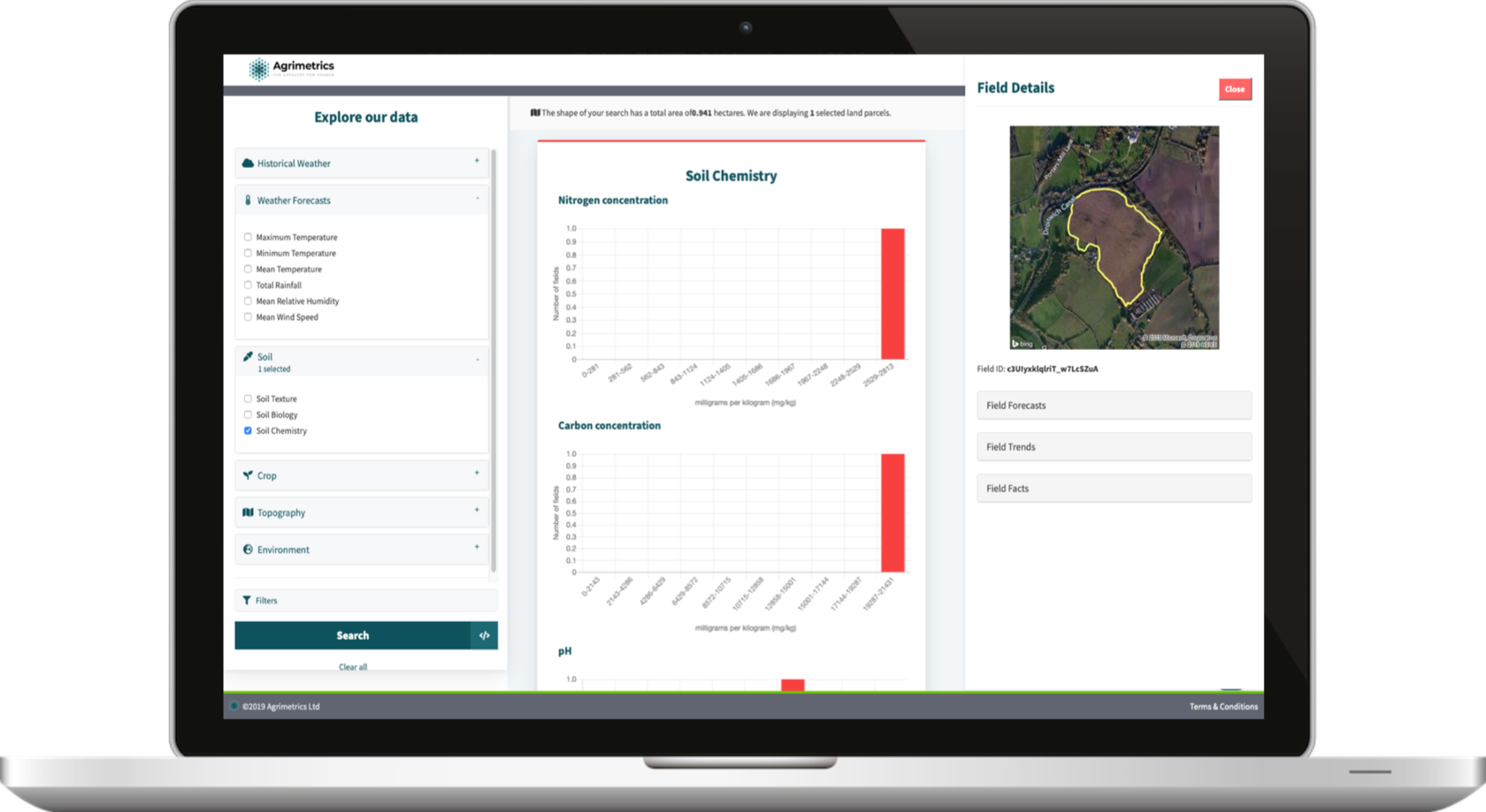
These boundaries were then connected to more than a billion other data points – creating an unrivalled resource for stakeholders across the agri-food sector – covering more than 2.8 million field boundaries across England, Wales, Scotland and Northern Ireland, says the centre.
Accessing Field Boundaries through Agrimetrics brings several additional benefits, adds Richard. “Field Boundaries provide a detailed digital map of the UK’s farmed landscape, what’s less well known is that they also provide a framework for organising and assembling data and the foundations for building new products.
“Here, Agrimetrics have provided a short-cut. We’ve linked our 2.8 million field boundaries to over a billion additional data points, including weather, previous cropping and soil composition. This expands the applications of field boundaries and provides significant time- and cost-savings for our users.”When the required information is not available through Agrimetrics, Field Boundaries provide the building blocks for assembling and analysing third party data. Processing satellite data is one example. Field Boundaries act as cookie cutters to slice up satellite imagery in order to provide summary statistics for all of the individual fields in the UK.
“This will enable the development of products which could measure in-season crop health and productivity – without ever having to visit a field.”
“As a result, land agents can develop a better understanding of land assets, in less time and using fewer resources. Agri-tech innovators can also accelerate the development of the smart tools, devices and predictive models which promise to revolutionise productivity and sustainability in our sector: wHen2gO, a water stewardship tool created by BASF, is just the first example of this.”