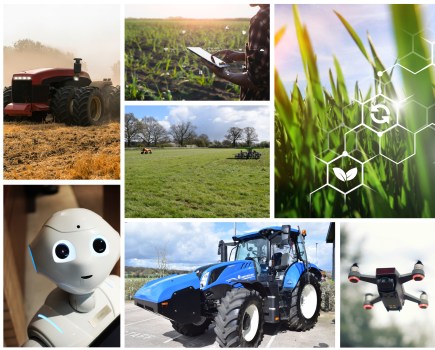
Digital technology is helping global agriculture break down the barriers of progress. CPM takes a look at how it’s making a difference, as well as the launch of an exciting innovation offer from BASF.
We’re at the beginning of a period of huge digital change and know there’s a large amount of data that can be gathered from the sky.
By Charlotte Cunningham
Whether you’re a self-confessed technophobe or are always downloading the latest precision farming app, there’s no getting away from the conversation about the surge of uptake in digital technology.
These tools are developing at a rate of knots, allowing growers to push their potential in the field –both from the ground and above.
Last year saw BASF’s digital entity, xarvio, launch an Innovation in Agriculture survey which offered some really interesting insight and guidance on exactly where growers are at, in terms of the adoption of on-farm digital technology. “One of the main things we could take from the survey is that a huge number of growers are already utilising digital technology – with 79% saying they’ve been using these tools for at least a year,” explains the firm’s Louis Wells. “Comments also included that by incorporating them on farm, growers have been able to push yields and manage inputs better.”
Looking at the bigger picture – specifically the next five years – the survey also showed that digital tools and precision farming technologies were believed to be one of the top three most important innovations, alongside new chemistry, and crop-breeding developments, explains Louis. “For me, it’s really exciting to think about how these three aspects will work together to boost profitability on farm.”
Delving deeper into the digital side of things, the survey also looked at which key factors were needed to make digital and precision technology an integral part of farming practise. “100% of those who responded to the survey agreed that in the future, digital tools and precision technologies will be important in the advancement of arable farming, however, to do so, it needs to be cost-effective – with a proven benefit – and the systems have to be compatible and connected.”
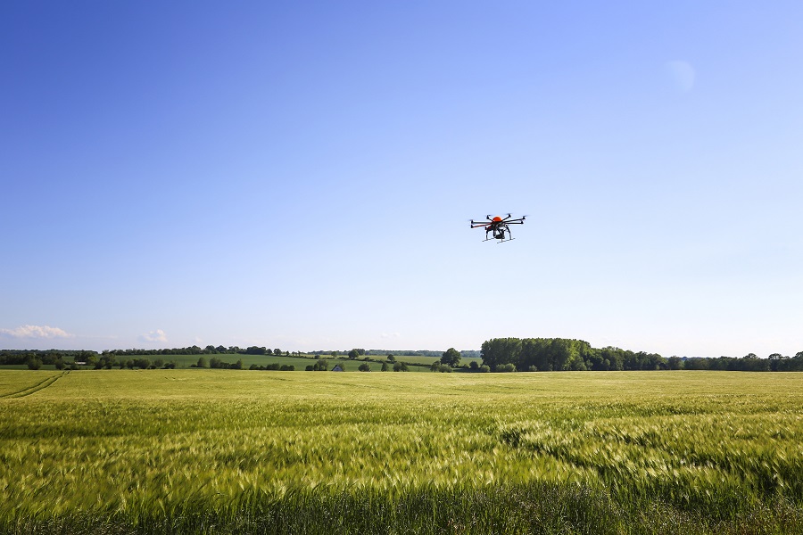
And of these emerging digital technologies the survey revealed that in-field imagery of crops was deemed as one of the most influential tools. “Whether it be from a drone, or a satellite, being able to spot variable patches in fields – and being able to look closely at them remotely – is something we know is incredibly important, and this has actually been one of the main drivers in BASF’s Innovation Offer, which offers the chance for growers to get their hands on a drone – and full aviation training – in a bid to drive more informed decision making on farm.
“We’re at the beginning of a period of huge digital change and we know there’s a large amount of data that can be gathered from the sky. Giving customers a chance to win prizes like this enables them to enhance what they’re doing and push the boundaries.
“This is a really important part of our strategy – we have cutting edge crop protection solutions and it’s great to enable winners to experience some of these emerging digital technologies and see how they can benefit crop production.”
One of last year’s winners, Mike Shand, has recently passed his drone exam and says he’s looking forward to exploring the DJI Mavic 2 pro drone’s potential. “It’s early days for us but we’ve been using the drone to look at the building and the fields to see things from a different angle.”
Mike is the farm manager at the Seafield estate in Aberdeenshire, managing 1800ha of arable land, and with a high level of rainfall on farm, says the drone will be incredibly beneficial when it’s too wet to travel.
Though the training is comprehensive, this shouldn’t deter growers from getting involved this year, he adds. “It’s a very thorough and complicated training package, so I definitely had to pay attention, but as long as you do the revision, it’s easy enough to pass the final exams.
“I’d always fancied a drone as a toy but would probably never have bought one. However, this is going to be great for looking at crops and getting a better view from the top.”
Suffolk grower, Chris Flatt was one of the 2020 Innovation Offer winners and, having recently received his drone, is currently experimenting with using it on his 250ha farm. “We use a fair bit of digital/precision technology on farm, mainly for improving our accuracy – I was actually on the verge of purchasing a drone when I won the competition. So it’ll be interesting to see how it complements our other digital tech.”
One of the drone’s first flights was over crops Chris sprayed at the end of last year. “I’m the sprayer operator, so I spend a lot of time looking at crops and the drone gives me a different perspective rather than just crop walking. In the future, this may be useful for judging things pre-application.”
Going forward, Chris plans to use the drone to overfly and survey all of his crops. “Due to the interesting autumn, we have some late broadcast wheats which we know will be patchy, so I’m looking forward to being able to see from above how they’re developing prior to applying fertiliser. At the end of January/beginning of February the drone will be helpful for looking at green areas.”
Of course, the abilities of drones go far beyond the farm gate and Chris also has plans to use his drone to make videos for the county-level field hockey teams he coaches. “I’m looking forward to seeing just how much I can get out of it.”
Scan the can 2021
Following several years of success, BASF’s “scan the can” Innovation Offer initiative returns for 2021, explains Louis. “It’s a really exciting competition and once again this year there’s an array of great prizes up for grabs.
“If you scan 10 litres of Revystar XE, you’ll get a free pair of waterproof socks, if you scan 50 litres, you’ll be entered into a draw to win waterproof clothing, and if you scan 100 litres of product, you’ll be in with a chance of winning the top prize – a drone, along with being awarded a remote pilot certificate after full aviation training.”
So how can you get involved this year?
If you purchase Revystar, all you have to do is sign up for the competition online and download the Companion app to scan your can, he explains.
“The Companion app is a tool to be used with product offers in the UK to help identify and confirm proof of purchase. It works by scanning a unique data matrix code on BASF products, which looks similar to a QR code, with your smartphone’s camera. The app will automatically log the product against your specific account.
“When signing up for the BASF offer on our website, you will have received a unique code. It’s this code which you need to activate your offer on the app.
“On the active offers screen simply press the ‘add offer’ button to the bottom right of the screen and enter your code. Your offer will now be activated, and you can go ahead and scan your qualifying product.
“All cans in the UK have a data matrix code which sits on the side of the can, identifying the product, and it’s unique credentials. Interestingly, this was initially developed as a supply chain counterfeit protection tool, but we’ve been able to adapt it to deliver an exciting innovation offer for growers.”
More information about the 2021 Innovation Offer can be found on BASF’s website: basfrealresults.co.uk/revylution/
xarvio update
Now one of the fundamental parts of BASF’s digital strategy, xarvio came to the firm in 2018. “For us, with these new digital innovations, it’s all about unlocking the value and potential this technology can deliver on farm.” explains Louis.
In the UK, xarvio’s Field Manager tool is most in vogue, after an official launch at LAMMA 2020. “While it’s a fairly new product, it’s growing rapidly. At the end of the 2020 season, there were more than 30,000 farms across Europe making use of the technology – more than 2M ha.”
And while it’s still relatively fresh, there are a whole host of new features now available to growers to take functionality one step further.
This includes the addition of the Leaf Area Index (LAI) biomass map which provides users with a measurement that looks at all leaf area in the field.
This means that growers are able to follow the variability of the crop – from stem extension in March, right the way through to harvest, explains Louis. “Most maps on the market are relative for each field in a given moment in time, but with LAI, you can compare maps from different fields and across the season.
“Subsequently, monitoring crop development for more of the growing season allows farmers to better optimise application planning, and compared with NDVI-based maps, this system reduces saturation issues.”
When teamed with the Zone Spray function, users can also plan for variable application of fungicide/PGR/nutrition using the regular in-season LAI biomass maps, he adds.
The drone direction
Across the world, drones are playing a critical role in addressing some of the biggest challenges facing global agriculture.
The Food and Agriculture Organisation’s (FAO) E-Agriculture in Action: Drone for Agriculture report states that as farming communities have to adapt agricultural practises to overcome issues like climate change and food security, ICT-driven tools and technologies to enhance decision making through accurate, reliable and timely information have an important role to play. “In the current milieu, use of sustainable information and communication technology in agriculture in not an option. It is a necessity,” said the FAO’s Gerard Sylvester.
The report also shares some interesting case studies of how drones are being used across the world, showing that the possibilities are endless for UK agriculture.
These examples include the use of a small UAV on a coffee plantation in India. According to the report, in 2016 a small UAV was used to survey land use in a coffee plantation and the results provided the landowner with exact area measurements of land utilisation to determine the precise area under a coffee plantation to estimate yields. Without the drone, this process would have been very costly and time-consuming as the estate was located in a mountainous region with limited access.
In South and South-East Asian countries, rice crops have been a prime focus for the development of integrated remote sensing and ICT-based monitoring, mapping and yield estimation in order to target food security – which is closely connected to the livelihoods of smallholder farmers.
In 2012, the International Rice Research Institute and private partner, Sarmap, launched a project titled “Remote Sensing Based Information and Insurance for Crops in Emerging Economies (RIICE)”.
The project was funded by the Swiss Agency for Development and Cooperation (SDC) and was a public-private partnership aiming to reduce the vulnerability of smallholder farmers engaged in rice production.
Satellite-based rice monitoring initiatives were created, integrating remote sensing, crop modelling and ICT tools to generate and provide near-real time and accurate information on rice growth, yield – as well as damage caused by abiotic and biotic stresses.
Today, the RIICE technology is capable of providing accurate village-level information about rice planted areas, including information on the start of the season and its variability with geography, expected and actual yield and the impact of any disaster on specific rice growing areas.
RIICE is now providing accurate and almost real time information for the implementation of crop insurance programmes in various countries. According to the FAO, these projects have already made significant impacts in terms of rice monitoring, mapping and forecasting. “This integrated system combining remote sensing, crop modelling, web geographic information system, smartphones, UAVs has generated promising results in all countries. With more than 85% accuracy, over 24.5M ha of rice was monitored in 2016, a huge increase from the 1.6M ha when the initiative started in 2012.”
Partnership and agreement with national and state governments have also been established on the use of the RIICE technology for food security and crop insurance policies and substantial investment has been received from state governments in the Republic of India and the Republic of Philippines.
The FAO has also partnered with national counterparts to develop systems that can use drones for data collection in a bid to assist with disaster risk-reduction efforts.
The idea behind this is that this data can be fed into modelling systems with analytics capabilities that can then provide valuable insights.
According to the FAO, such information can provide rural communities with high-quality reliable advice and can assist the government in better planning disaster relief and response services.
The drones used by FAO in the Republic of the Philippines are equipped with photogrammetric and navigation equipment with a ground resolution of up to 3cm. This can be programmed to detect details such as NDVI, water stress or lack of specific nutrients in crops. The drone-supporting mapping efforts in the Republic of the Philippines are now being mainstreamed under the FAO’s disaster risk reduction and management and climate change adaptation strategies.