
Baseline soils information collected since the 1970s is for the first time freely available for anyone to use. CPM talks to the custodian of the data to assess its significance.
“After years when it was only available commercially, it’s high time it was free for all to access to help drive land management decisions.” PROFESSOR STEPHEN HALLETT
By Mike Saull
With more than 250,000 observations and 30,000 soil samples from 12,000 profile pits, the UK’s largest soils database is now just one click away from a farm computer.
Thanks to collaboration between Defra and Cranfield University, all data collected as part of a major mapping programme started around 60 years ago, is now in the public domain. As a result, farmers, advisors and scientists can dig deep into a national archive detailing a host of soil properties from land right across England and Wales.
Originally produced by a dedicated group of soil surveyors – who worked actively across England and Wales to map and describe soil types and list their characteristics – the data has been digitised, so should now prove more useable.
Many farms may have an original soil map that’s faded and tucked away in an office drawer. This gave a host of details, for example, texture, organic matter, drainage and soil water availability – in fact, all the baseline information on the varied soils across the farm’s landscape.
Cranfield University’s ‘Land Information System’ (LandIS) is the digital representation of all of this painstakingly collated information. According to its custodian, Professor Stephen Hallett, chair of applied environmental informatics at Cranfield’s Environment Centre, this poses the best and most comprehensive data on the top 2m of the UK’s land resource, and is a highly valuable record.
“It’s an exciting moment when a collection of national importance is openly available for free,” comments Stephen. “After years when it was only available commercially, it’s high time it was free for all to access to help drive land management decisions going forward.”
Access is via the Landis Open Soil Data portal. To interrogate the data, individuals create a free account with a username and password. Farmers should then be able to locate their holding easily, then check on the properties of their soils in further detail.
“Drill down into the map and you’ll discover the details of your soil type – either listed as a Soil Series or Soil Association,” explains Stephen.
Properties listed include each soil’s seasonal drainage risk or susceptibility to drought, the typical crops it can support, its inherent fertility and organic matter content and the types of natural habitats associated with the landscape being farmed.
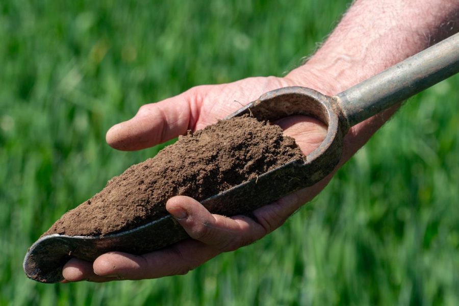
Detailed chemical and hydrological analyses are also available down to a sub-group level, and there’s even data on any original individual auger or soil pits taken across the area by each individual surveyor, including texture, colour, stoniness, depth of the different soil horizons and subsoil matrix colour and mottling.
While some of these characteristics will change over time, much of the baseline data is linked to the physical properties of the soil, notably its texture and position on the landscape and so should remain highly relevant, points out Stephen.
“By zooming in on an area you can look at the potential for the land and its pros and cons, giving you an insight into the natural order of soils,” he says. “We understand farmers know their own land better than anybody, but this data is a valuable source of information, helping to explain why, for example, one area lies wet for longer, or is quicker to dry out. It will also give perspective, placing individual blocks of land in a regional and national context.
“Hopefully, agronomists working across a wider region can log in to look at their area and be able to provide clearer advice that mirror local soils. Defra and other government agencies will be able to zoom out further and look at land-use frameworks.”
Stephen highlights that his team has been working with various companies and government bodies for some time, including those working in precision farming, helping to develop many soil-related products and turn-key assessments.
“Now, everyone can gain access to and customise the data which should help create a range of applications, and potentially attract new businesses who can apply it to the farming industry. In the first month of the release of the newly available map data, despite little publicity, more than 1000 users logged in, so there’s clear interest,” says Stephen.
He adds that in addition, Cranfield University will continue to offer other services, helping to utilise the data to its best advantage, drawing on the team’s deep-rooted soils knowledge. “Environmental consultants, geotechnology firms, policymakers and others with a broad interest in what’s the foundation block for all life, should also value the data.”
Dr David Smedley, head of soil and peatland science at Defra, heralds the widespread release of the soils data, perceiving it as a significant milestone in how soils can be factored into policy, research and decision-making.
He points out that the new Land Use Framework recognises soil as one of society’s greatest and most consequential natural assets. “Around 95% of our food depends on it, it regulates our water, and is arguably our most biodiverse ecosystem and our largest terrestrial carbon store,” he says.
The Land Use Framework also specifically commits to improving access to high-quality data, and for good reason – six of the 10 goals in the government’s Environment Improvement Plan make reference to soil, further underling its importance in tackling a broad range of environmental challenges.
“Put simply, a resilient, sustainable food system and thriving natural environment can’t be achieved without healthy soil. Allowing access to the best soil data sets available is critical to ensuring soils are properly embedded in our thinking and decision-making, not just within government, but wherever land management decisions are made. Releasing the National Soil Map and LandIS datasets is a major step forward in achieving this.”
Releasing these datasets should unlock significant benefits for environmental management, research, innovation, and policy, and enable the development of new tools and decision-support systems to help deliver multiple Defra objectives, he concludes.
This article was taken from the latest issue of CPM. Read the article in full here.
For more articles like this, subscribe here.
Sign up for Crop Production Magazine’s FREE e-newsletter here.